NAHRAIN AI
A digital platform focused on understanding, visualising and working with water-related data and simulations in Iraq.
The operational friction we set out to resolve.
Hydrological data across Iraq is historically dispersed across disconnected field gauges, isolated ministry spreadsheets, and paper records. During seasonal droughts or flood releases, water managers lacked a unified telemetry interface to simulate downstream impacts in real time.
How the architecture works in production.
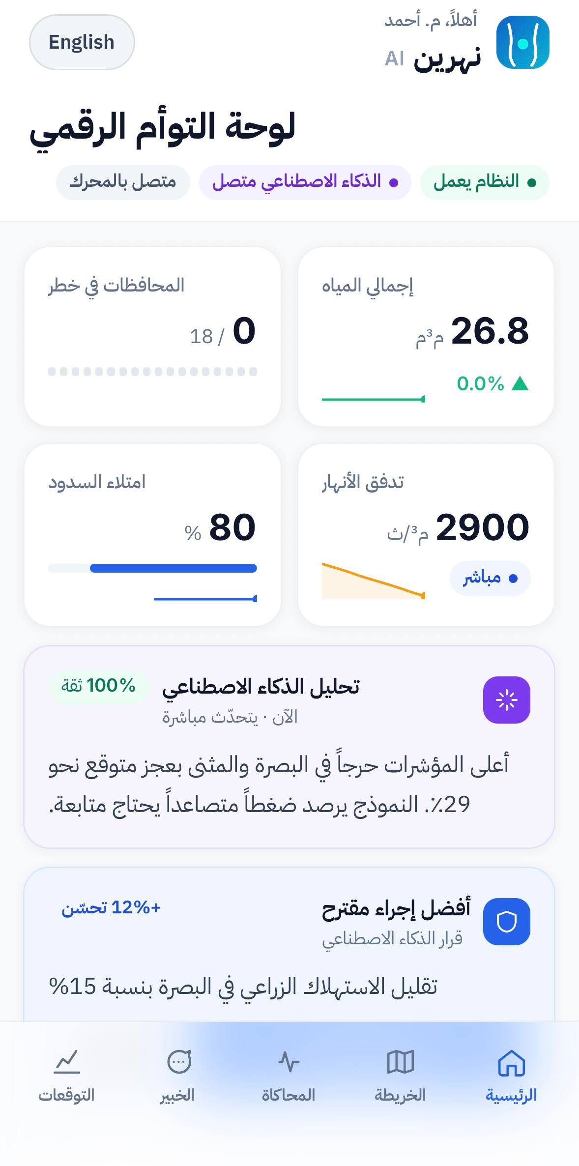
A centralized spatial digital twin and field mobile telemetry system ingesting 82 sensor streams, running predictive hydrodynamic wave models, and rendering basin elevation telemetry on Tigris and Euphrates river reaches.
Crafted for high performance and daily usability.
Every feature is demonstrated through its actual interface implementation.
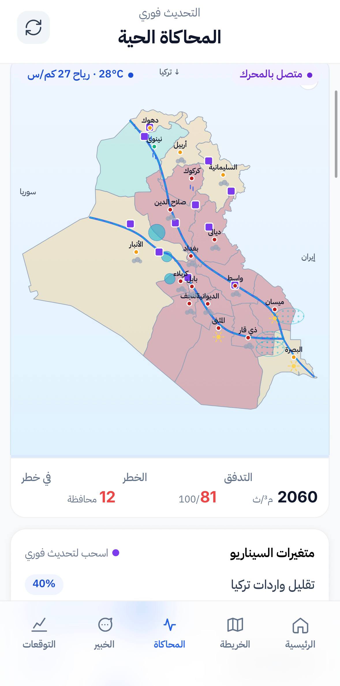
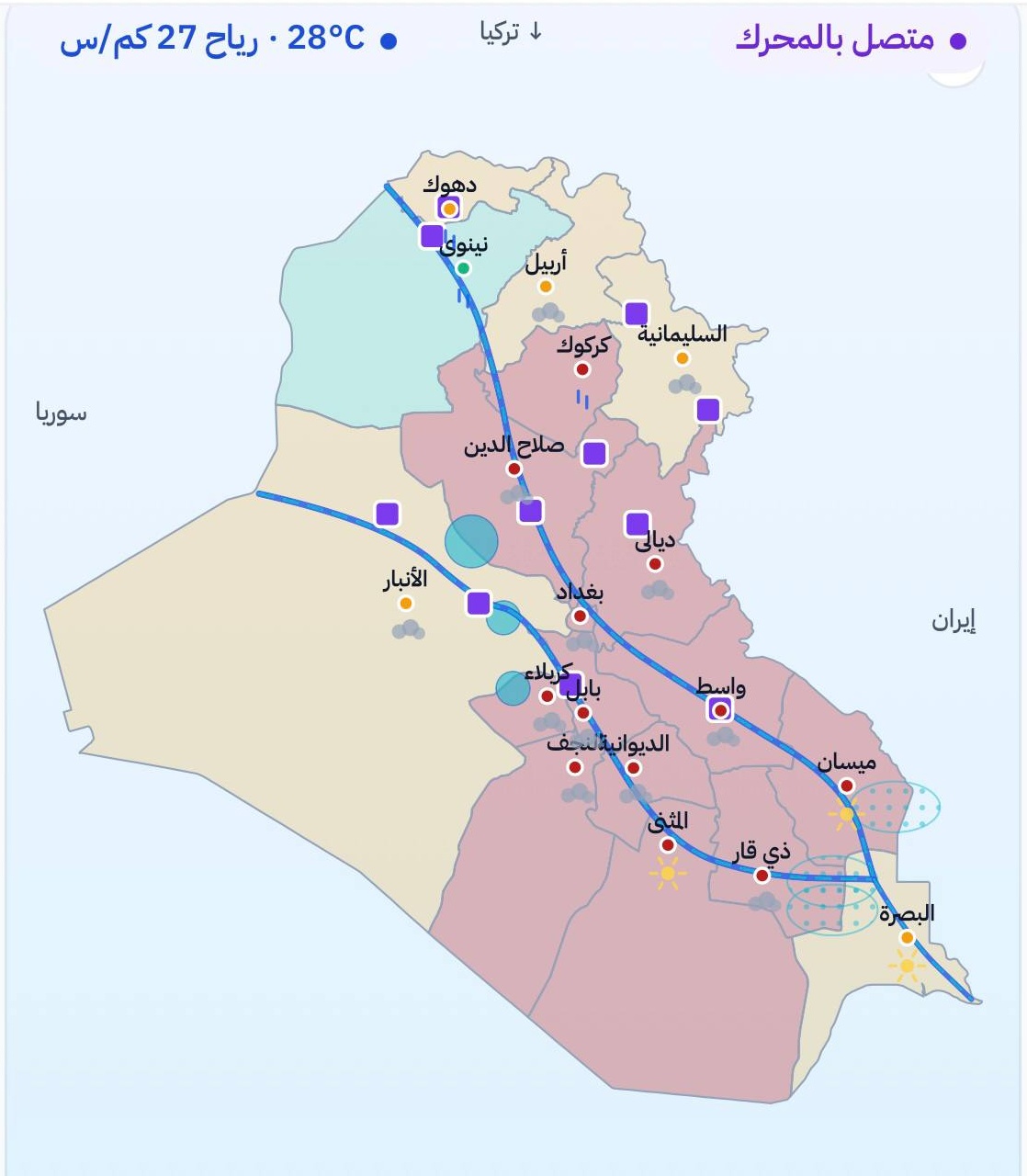
Real-Time Spatial Basin Map & Simulation
Renders the entire Tigris and Euphrates river network with interactive telemetry stations, live flow rates (2,900 m³/s), and scenario modeling across all 18 governorates.
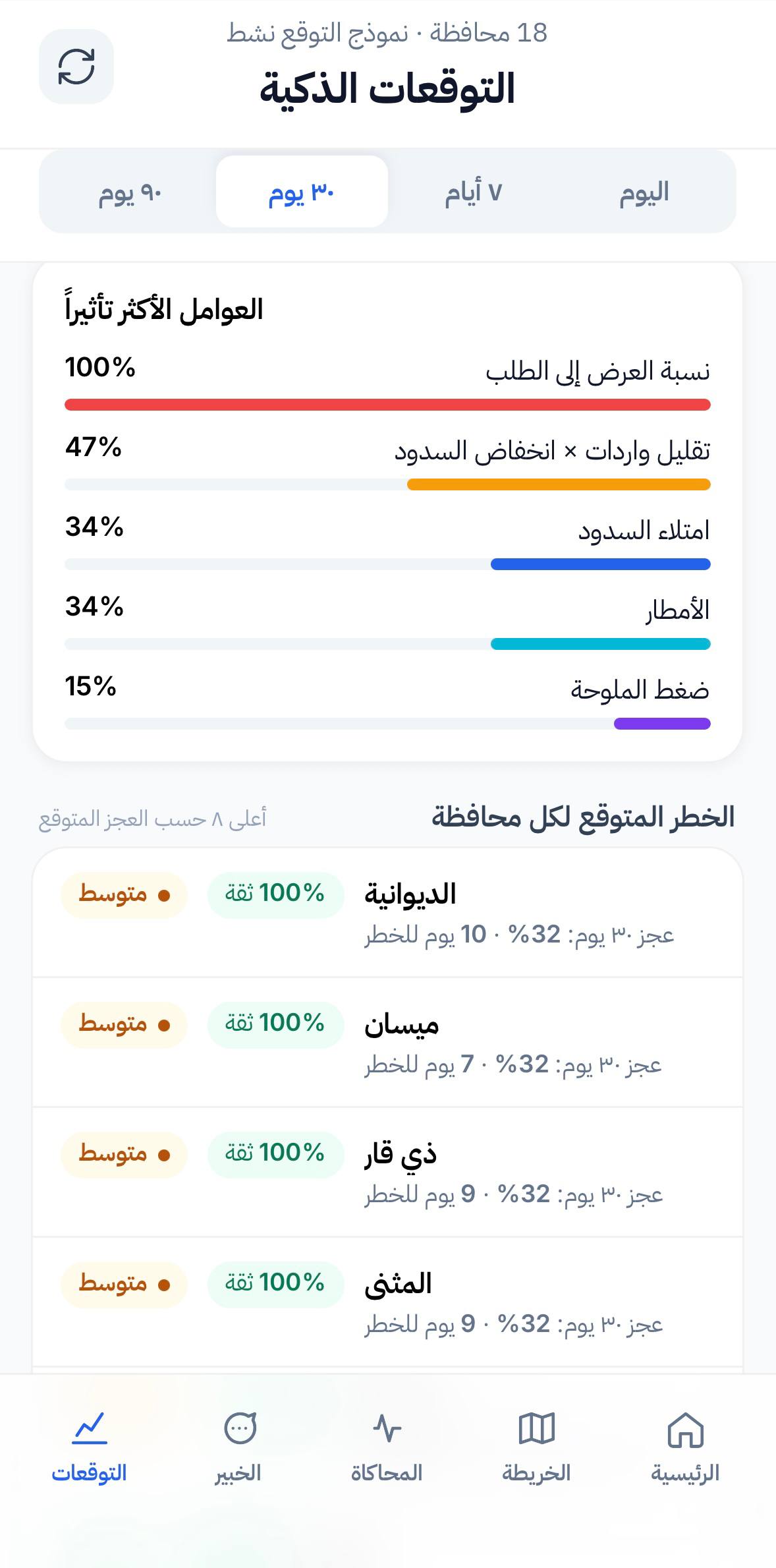
Predictive 30-Day Hydrograph & Risk Analytics
Generates 30-day discharge models comparing supply-to-demand ratios, upstream dam capacities, and salinity pressure to forecast provincial deficits.
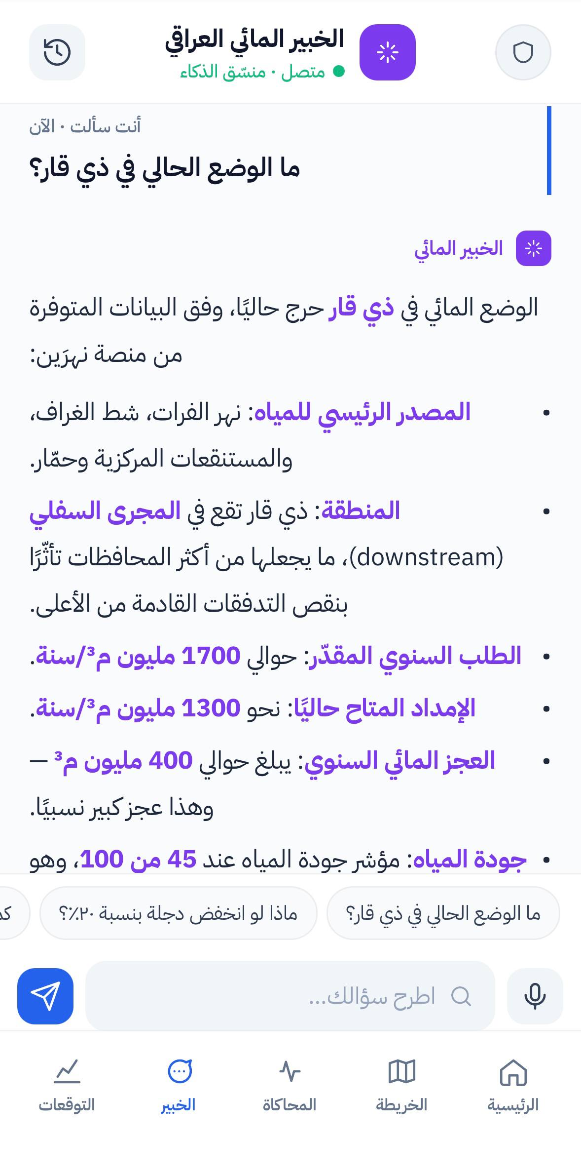
Domain AI Hydrology Expert Assistant
Context-aware AI coordinator responding in real time to catchment inquiries, water quality indexes, and downstream deficit impacts.
Dedicated product interface showcase.
Original product colors, readable typography, and uncompromised touch targets.
How FORSA approached and engineered this product.
Collaborated directly with Iraqi hydrology researchers, built custom vector tile GIS pipelines to avoid external proprietary map overhead, and optimized WebGL client rendering for rugged field mobile devices.
Verified production outcome.
Unified basin monitoring interface providing clear operational telemetry without reliance on external generic map frameworks.
Have a problem worth solving?
We engineer serious digital products and AI automation systems for Iraqi enterprises. Let’s examine your operational challenge.